It’s no secret that Austinites have an affinity for fitness. Austin, TX was ranked America’s 10th fittest city by the Huffington Post last year and 7th best city for runners by Forbes.com, so it stands to reason that there are a wealth of trails, streets, and tracks available to keep Austin in the healthy elite and meeting all those pesky New Year’s Resolutions. From the obvious running choices to the secret gems awaiting your footfalls, Austin’s running terrain is as broad as the Lone Star State.
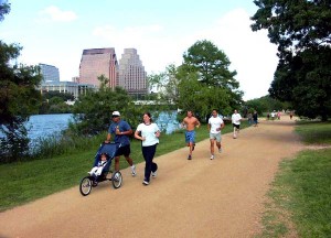
Lady Bird Lake Hike and Bike Trail
Whether you’re training for the Austin Livestrong Marathon or you’re a weekend huffer, there are plenty of places to hit the road and put in a couple miles before work. For beginners, you can try the friendly trails around Auditorium Shores. The 3.2-mile loop from the South First Bridge down to the Mopac Bridge is the best place for newbie runs or quick tune-ups. The trail also offers 7 and 10 miles loops for the more experienced and eager, but you’ll be safe keeping it to 3.2 miles with two water stops along the way and a RunTex nearby. You’ll also gain inspiration from all the other runners along the trail. Learn more.
Shoal Creek Hike and Bike Trail
The Shoal Creek Hike and Bike Trail offers a stunning 3 miles of terrain in Central Austin (6 for a round trip). It’s a little bit less groomed than the Lady Bird Lake Hike & Bike so be prepared to do some root and rock dodging along the way. You park at the trailhead at 2600 N. Lamar Blvd or pick up the trail from Lady Bird Lake Hike & Bike between Caesar Chavez and Lamar Blvd. Learn more.
Brushy Creek Trail
The Brushy Creek Trail is a great gravel-paved trail located in the Avery Ranch area of Austin, TX. Running parallel to Brushy Creek and offering 2.5 miles one-way, Brushy Creek Trail offers adequate biking, running, and walking in a pet friendly atmosphere. Learn more.
Barton Creek Greenbelt
The Barton Creek Greenbelt is Austin’s largest green space right in the heart of the city. Beginning at Zilker Park, the trail leads southwest through 7.25 miles of dense foliage, limestone cliffs and various waterfalls through the greenbelt. This trail is usually heavily populated by mountain bikers and contains some rough terrain by the Mopac/360 trailhead. But once you get down alongside Barton Creek, it’s easy going. During the summer months, the Barton Creek Greenbelt offers shade but is usually very humid due to the canopy overhead. It is considered the 7th best trail in the state of Texas. Learn more.
Travis Heights Neighborhood
Depending on where you live/work, running in residential neighborhoods are a great bet for steady running with no limit on mileage. One of the better neighborhoods in town for running is the Travis Heights neighborhood. Offering arteries of quiet residential streets, this safe, hilly neighborhood is residential running at its best. You can follow along Blunn Creek or run along the South Congress entertainment district. Learn more.
McKinney Falls State Park
The McKinney Falls State Park is a truly picturesque area in Southeast Austin that is host to running trails, water falls (if you catch the season right), some Austin history and “Old Baldy” one of the oldest bald cypress trees held on public land. Both running trails, the Onion Creek Hike and Bike Trail and the Homestead Trail provide several miles of terrain as well as several hundred feet in elevation gain. There is an entrance fee of $6, but it’s well worth the cost, as this is one of Austin’s hidden gems. Learn more.
Hyde Park Neighborhood (Alphabet Streets)
While Travis Heights is a bastion for residential running to the south, the Hyde Park neighborhood’s alphabet streets offer equal safety and terrain for central Austin. Avenues A – G run parallel from 38th Street all the way to 51st and sometimes beyond. A run through these quiet, residential street leaves plenty of time for deep contemplation. Learn more.
Other Running Trails
- Bull Creek Park & Greenbelt
- Walnut Creek Metropolitan Park
- Bull Creek Greenbelt
- Emma Long Metropolitan Park
PRO TIP: MapMyRun.com can help you find out different routes in your own neighborhood, allow you to specify your location, distance, and vertical ascent.
This post was provided by the Austin running enthusiasts at Realty Austin.


